- BARTON-ON-HUMBER
- Visit Barton
- Travelling To Barton
- Places To Visit
- What's On Guide
- Places To Stay
- Discover Barton
- Images of Barton
- A-Z of Places
- Local History
- Genealogy
- Barton Life
- Community
- Organisations
- Education
- Places of Worship
- Events
- Venues
- Entertainment
- Eating Out
- Pubs & Clubs
- Leisure & Recreation
- Sport
- Pastimes
- Local Links
- Local Web Sites
- Useful Links
- bartonuponhumber.org
- InBarton
- BartonBikeNight
- Directory
- Business
- Leisure
- Other
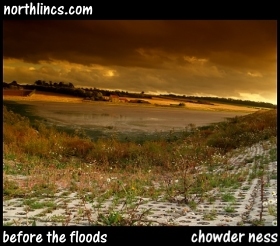
 Chowder Ness Foreshore Development involved selecting suitable farmland on the south bank of the River Humber to be flooded. Prior to parts of the original shoreline being removed the project involved the shaping of new embankments which were then covered with protective stonework .
[Bigger Picture]
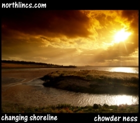
 The existing sea defences were then breached to allow the waters of the River Humber to flow onto farmland and up to the newly created banks. The ebb and flow of the tide leaves deposits of sediment to create new mud flats in a process known as ‘accretion’.
[Bigger Picture]
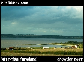
 The project was completed in 2007 on the inter-tidal farmland formerly reclaimed from the Humber. In time the mud flats will turn into salt marshes creating a new and important inter-tidal habitat which will attract wildlife such as shelduck, lapwing, golden plover and curlew.
[Bigger Picture]


